Several forecast models are now showing trends of a return to colder weather, towards the end of next week (11-13 January). Both the GFS Ensembles, and the ECMWF weather forecast models both currently show indicators of this trend.
Whilst it's still too early to attempt a "snowcast", the trend towards colder weather certainly points to the possibility of wintry conditions from next weekend onwards, including potential snow falls.
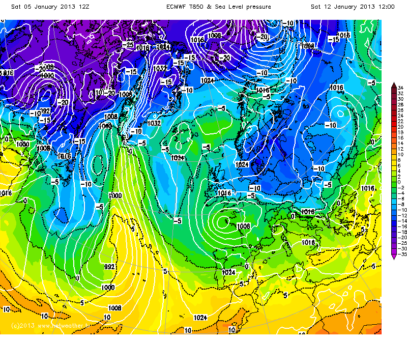
The below chart for next weekend (from today's 12Z ECMWF forecast model) shows cool air being drawn in from the East/North East. As the time-frame is advanced further, the airflow shifts even more northerly, towards the start of the following week, reinforcing the cold pool of air over the UK (click image to enlarge).
Could "winter" finally be on its way? Watch this space! :)
(Chart supplied courtesy of Netweather.tv, reproduced here with permission).